Geospatial Study of Japan.
Okinawa Islands
There is a set of islands around the southern end of Japan, similar to a state in the US, that are called the Okinawa Prefectures. The chain of the hundreds of the Ryukyu Islands are over 620 miles long, that goes from southwest from Kyushu to Taiwan. Naha is the capital of the Okinawa Island and by far the largest city. Another city is Nago which is a former Expo site known for its aquarium. All Okinawans speak Japanese, but some also speak Ryukyuan which is a separate language referred to as Okinawan dialect by mainland Japanese.
A 7.0 earthquake struck the prefecture on February 26, 2010 and hit the news immediately. Because of the tsunami warning issued there was little damage from the earthquake.The Ryukyu Islands earthquake occurred near the boundary that accommodates most of the relative motion between the Philippine Sea and Eurasia tectonic plates. Most of these islands are made up of coral rocks and limestone, overtime, since the limestone has eroded there have been caves formed. The buildings are mostly made of concrete, cement roof tiles, and covered windows because of the tropical storms and typhoons in the region. The Philippine and Pacific plate are converging and that pushes up the land, which forms the land.
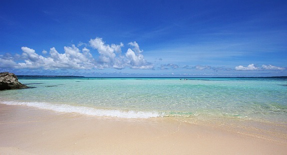
This is a subtropical climate and are warmer than the mainland of Japan, the temperature usually stays around mid to high 70 degrees fahrenheit. Because of this climate sugar cane, pineapple, and papaya are all produced by Okinawa. Okinawa is popular to visit because it is similar to a Hawaiian tropical, beachside atmosphere. Naha has a castle of the Ryukyu Kingdom and is near the Shinkina Gardens. The beaches include the Emerald Beach, Zanpa Beach, Renaissance Beach, Manzamo Beach, and Ikei Beach. Not only are there plenty of beaches to see, there are castle ruins such as Shuri Cast;e, Katsuren, and Zakimi.
The Okinawa Islands were once an independent kingdom state to China for many centuries, then came under control of the Satsuma feudal fief in the 17th century, and were made Japanese prefecture in 1879. Toward the end of WWII, the island became the stage of one of the war's bloodiest battles when the American troops invaded the islands. Okinawa remained under US administration until 1972, while many US military bases remain on Okinawa Main Island today.
Although the Okinawa Islands have recently had an earthquake and vulnerable to Tsunamis, earthquakes, typhoons, and tropical storms it is popular for vacationing for the beautiful beaches and clear blue-green water and many castle ruins and sites to view. These islands are very famously known and the next time I return to Japan I would love to experience the castles and clear ocean waters. The way this land is formed is very unique as well, by way of the converging of the plates in the earth.

en.wikipedia.org/wiki/Okinawa_Prefecture
geography.about.com/od/japanmaps/a/okinawajapan.htm
wikitravel.org/en/Okinawa_Island
http://www.japan-guide.com/list/e1247.html